New DJI drone maps 38 square miles daily, offers 3,117-foot range
Source: interestingengineering
Author: Interesting Engineering
Published: 11/16/2025
To read the full content, please visit the original article.
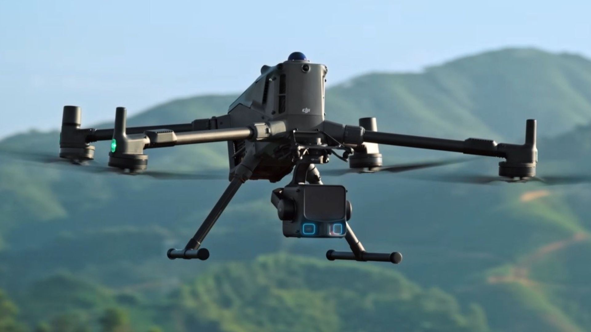
Read original articleDJI has introduced the Zenmuse L3, an advanced aerial LiDAR system designed for high-accuracy geospatial data collection. Integrating a long-range 1535 nm LiDAR sensor, dual 100 MP RGB cameras, and a high-precision POS system, the Zenmuse L3 can map up to 100 square kilometers (about 38.6 square miles) per day. It offers a detection range of 950 meters (3,117 feet) on objects with 10% reflectivity and features adjustable pulse rates to adapt to different environments. The system achieves vertical accuracy ranging from 3 cm at 120 m altitude to 10 cm at 500 m, supporting detailed mapping scales of 1:500 to 1:2000. Its laser beam divergence of 0.25 mrad enables detection of fine features like power lines and branches.
The Zenmuse L3’s dual 100 MP cameras with 4/3 CMOS sensors provide a wide
Tags
robotdroneLiDARmappinggeospatial-dataaerial-surveyingDJI-Zenmuse-L3