Robots to navigate hiking trails - Robohub
Source: robohub
Published: 1/12/2026
To read the full content, please visit the original article.
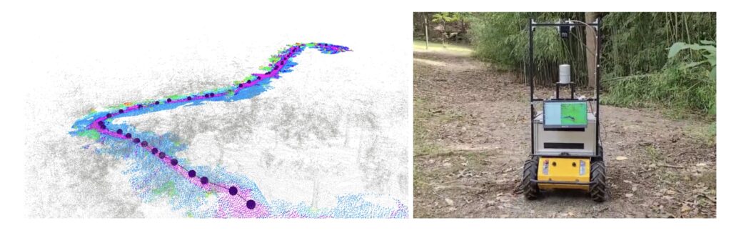
Read original articleThe article discusses the development of autonomous robots capable of navigating hiking trails, a challenging task due to the unpredictable and varied terrain conditions such as fallen trees, uneven ground, erosion, and environmental changes after storms. The motivation behind this research is the potential real-world applications of such robots, including trail monitoring and maintenance, environmental data collection, search-and-rescue operations, and assisting park staff in remote or hazardous areas. The complexity increases when robots must decide whether to stay on the trail to avoid environmental damage or leave it temporarily for safety reasons.
The key innovation presented is a dual perception system combining geometric terrain analysis via LiDAR and semantic terrain detection through camera images. LiDAR provides information on slopes and large obstacles, while semantic segmentation identifies specific terrain types like trails, grass, rocks, and roots. By fusing these data sources into a single traversability map, the robot can better assess safe paths. The researchers created a labeled dataset of hiking trail images and trained a model to recognize trail terrain effectively. Navigation
Tags
roboticsautonomous-navigationhiking-trailsLiDARsemantic-segmentationterrain-analysissearch-and-rescue