Space-based thermal maps reveal urban heat islands and how to fix them
Source: interestingengineering
Author: @IntEngineering
Published: 12/10/2025
To read the full content, please visit the original article.
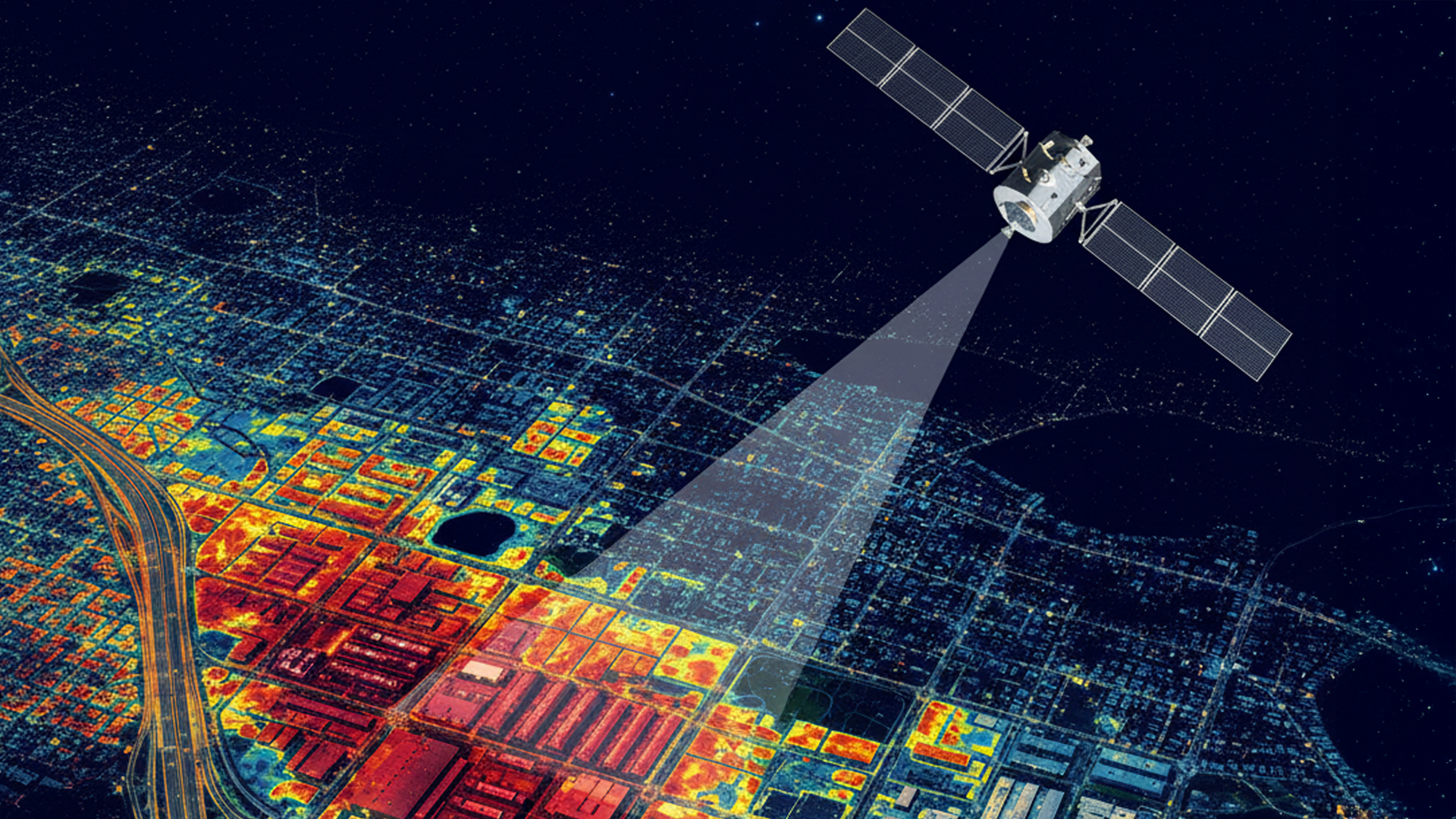
Read original articleThe article highlights how satellite-based thermal imaging is revolutionizing the identification and mitigation of urban heat islands (UHIs) in cities worldwide. High-resolution thermal maps from instruments like NASA’s ECOSTRESS on the ISS and upcoming commercial satellites such as the UK’s SatVu HotSat constellation allow city planners to pinpoint the hottest urban areas, often caused by dark asphalt, rooftops, and other hardscape materials that retain and radiate heat even overnight. This data-driven approach enables targeted interventions, such as planting trees, applying reflective coatings, and installing bioswales, to cool specific hotspots and improve neighborhood safety and comfort.
Several cities have already implemented pilot projects informed by thermal maps. Los Angeles combined reflective street sealants with large-scale tree planting, resulting in treated streets running about 10°F cooler than untreated ones. Philadelphia is testing reflective “CoolSeal” pavement in heat-vulnerable neighborhoods, aiming to reduce surface temperatures by up to 20°F and improve comfort in a humid climate. Similarly, Phoenix
Tags
energyurban-heat-islandthermal-mappingsatellite-sensorssustainable-citiesreflective-materialsclimate-resilience